DRE-Tasmania-logo

Cohga Secures Contract with Tasmanian Government for ACHRIS Implementation

Contract Awarded

In a significant milestone for cultural heritage management, Cohga has entered into a contract with the Tasmanian Government to implement their Aboriginal Cultural Heritage Information System '(ACHRIS), a comprehensive solution for managing Aboriginal heritage. The partnership represents a pivotal step forward in preserving Tasmania’s rich Aboriginal heritage and underscores Cohga’s unwavering commitment to delivering cutting-edge technology for cultural heritage management.

Aboriginal Heritage Register

The Aboriginal Heritage Register (AHR) is a vital database that houses information about over 13,000 significant places and objects related to the Aboriginal people of Tasmania. Although not publicly accessible due to its culturally sensitive content, the AHR serves several essential functions. These include collecting and managing site data, providing access to this information, offering legislative advice on heritage matters, assisting with compliance, and handling system administration and reporting. Initially developed in 2013 as part of proposed changes to the Aboriginal Heritage Act 1975, the AHR has encountered challenges due to the non-passage of expected updates, resulting in a system that is difficult to enhance and maintain.

Proven Solution

ACHRIS, Cohga’s Indigenous Heritage Information Management System, tackles these challenges by providing a web application that seamlessly integrates forms-based workflows with a spatial system. This enables staff, key stakeholders, and the public to query, report, and manage cultural heritage information within a single, user-friendly, spatially-enabled environment. Not only does the system enhance the efficiency of managing cultural heritage data, but it also ensures the preservation and protection of culturally significant information.

Proven Partnership

Cohga’s partnership with the Tasmanian Government underscores the company’s proven history of collaboration with government agencies throughout Australia. ACHRIS, along with its platform Weave, has been successfully deployed as cultural heritage databases and registers in three Australian states, with Tasmania being the fourth. These implementations serve as compelling evidence of Cohga’s capacity to provide efficient and user-friendly access to cultural heritage information, all while adhering to the requirements of the relevant Cultural Heritage Acts.

"We are thrilled to collaborate with the Tasmanian Government in implementing ACHRIS," said Aaron Van Herk, Cohga Director. "This partnership not only reinforces our commitment to preserving Aboriginal heritage but also highlights the strengths of the partnerships we have built with various government agencies. We provide a robust, adaptable, and user-friendly system that meets the specific needs of cultural heritage management."

Summary

The implementation of ACHRIS in Tasmania will be completed within this financial year. This significant milestone will significantly enhance the management of Aboriginal heritage information, ensuring its preservation for future generations while making it accessible to those who need it. Cohga remains committed to building strong partnerships with government agencies and leveraging technology to protect and manage Australia’s invaluable cultural heritage.

For more information about Cohga and its innovative solutions for cultural heritage management, please visit our website https://www.cohga.com/solutions/indigenous-heritage-management/.

carbon-calculator

Introducing the Weave Raster Inquiry Tool

Weave Raster Inquiry Tool

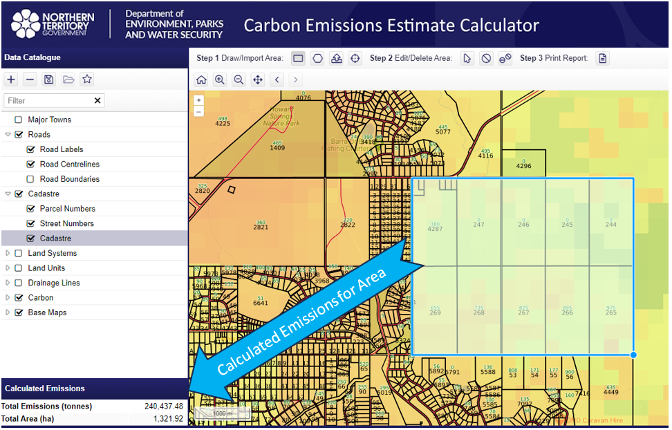
Cohga is pleased to announce the release of a new raster inquiry utility designed for the Weave platform. This utility allows users to perform raster statistical calculations using vector data inputs, offering practical applications such as measuring carbon footprints or flood heights in specific areas.

Configurable Capabilites

As with other Weave utilities, users have the flexibility to customize the tool's functionality through XML configuration settings. Currently, the Weave Raster Inquiry Tool is compatible with Oracle and PostGIS raster databases, and it can be easily adapted to work with other raster database systems like ArcGIS Image Server. This adaptability allows users to configure the tool for various calculations across different datasets, potentially spanning multiple database systems.

Example Site

This utility has recently been deployed for public use by the Department of Environment, Parks, and Water Security in the Northern Territory. They are utilizing it to measure Greenhouse Gas Emissions in designated areas, contributing to sustainable land management efforts. You can explore this system here https://nrmaps.nt.gov.au/carbon/carbon.html.

Summary

The release of the Weave Raster Inquiry Tool brings a useful resource for conducting raster calculations within the Weave platform. This tool offers flexibility for a wide range of tasks, from environmental assessments to geographic analysis. Its capacity to adapt and its practical use in environmentally important projects underscore its value across diverse fields.

Contact Us for further information about the Weave Raster Inquiry Tool. 

hands-typing-on-laptop2

Configuring Weave Clients an Introductory Series of Training Tutorials

Weave Training

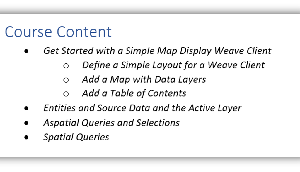
Cohga has developed a training course called Configuring Weave Clients.  It is a two-day introductory series of training tutorials that teaches the essentials of Weave from the perspective of configuring a Weave web client application. 

Configuring Weave Clients

Cohga provides a range of training courses that takes students from beginner to an advanced Weave user and administrator.

As an introduction to Weave we recommend that our customers undertake the Configuring Weave Clients series of training tutorials. The intent of this course is to equip students with a foundational knowledge to allow them to confidently approach the task of building their own Weave web clients, as well as managing their existing Weave clients. 


Training courses are demand driven, so we will work with you to schedule the training to meet your needs.

Contact Us for further information.

Nearmap-image(1200.1200)

Nearmap WMS 2.0 – Important Update

Nearmap WMS 2.0

As of August 2022 Nearmap have updated their WMS server, they have referred to this update as "WMS 2.0" but this is not a change to the WMS version supported by Nearmap, it is still 1.1.1, and is just used to indicate a new implementation of their server.

This change will break existing Weave toc model configurations for the Nearmap WMS map engines, since the change involved the renaming of all of the layers in Nearmap. The Nearmap WMS map engine in Weave still works as it did before, but you will need to update any toc models you have that relate to the Nearmap map engine to reflect the new layer names.

Note that you should ensure the id attribute for each toc model entry remains the same after the update so as to not break any bookmarks.

Please review the Cohga Wiki Page for the most recent information and updates on Nearmap.

Cohga Weave Webinar4 (2to1)a

Webinar – Weave Information Discovery Tools

Question

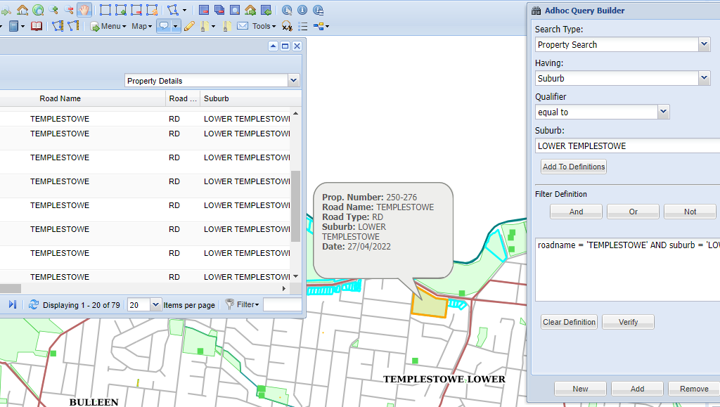
Did you know you can use Weave to interrogate your enterprise data systems? Did you know that Weave is an integration framework that can access information from any data source, both spatial and textual, in your organisation? Did you know that Weave has a powerful set of search tools that allow you to quickly find and use information relevant to your business need? Did you know that you can combine both spatial and textual searches to find the information you are looking for? Did you know that you can export information from Weave for use in other systems? Would this capability add value to your organisation?

Weave Information Discovery Tools

The Weave Information Discovery Tools allow a user to interrogate their corporate information using both spatial and textual search capabilities. Weave provides a range of simple to complex search tools to cater for different business and user needs. Queries can be as simple as entering unstructured text in a search box and doing a “Google” like search, or simply pointing to a feature on a map to identify it. Complex queries can be done using advanced SQL and spatial queries, or a combination of both. The aim of these search tools is to provide the means to quickly find the information needed for you to achieve your business needs.

Learn more about Identifying and Searching in Weave

Invitation

You are invited to attend an online demonstration of the Weave search and discovery capabilities. Fast and easy access to your corporate information is essential for good decision making and efficient business processes. This webinar will show you how to use Weave’s spatial and textual information discovery tools to improve outcomes for you and your clients.

Time:         11 AM (AEDT)
Date:        Tuesday 17 May 2022
Duration: 45 minutes

This Webinar is completed. You can view it here.

Cohga Weave Webinar4 (2to1)a

Webinar – Weave Redline Tool

Question

Did you know you can use Weave to create and annotate maps to convey meaning through cartography? Did you know that Weave has a powerful markup tool that allows you to annotate a map with features in a separate layer? Did you know that these annotations can be manipulated, stored and recalled as required? Would this capability add value to your organisation?

Annotate Maps

The Weave Redline Tool is a simple but powerful browser-based mark-up tool that allows you to create, draw, and edit cartography elements to annotate items on a map. Redline annotations can be created from existing elements, or drawn freehand with feature snapping. Redline annotations can be printed as a map report greatly assisting readability and understandability of the data.

Learn more about the Weave Redline Tool and other capabilities.

Invitation

You are invited to attend an online demonstration of the Weave Redline Tool to explore its capabilities and learn how it can be used to improve outcomes for you and your clients.

Time:         11 AM (AEDT)
Date:        Thursday 2 September 2021
Duration: 45 minutes

This Webinar is completed. You can view it here.

Drone in Agriculture

DIY Drone Mapping Workshop for Agriculture

Cutting-edge solutions to improve farming outcomes

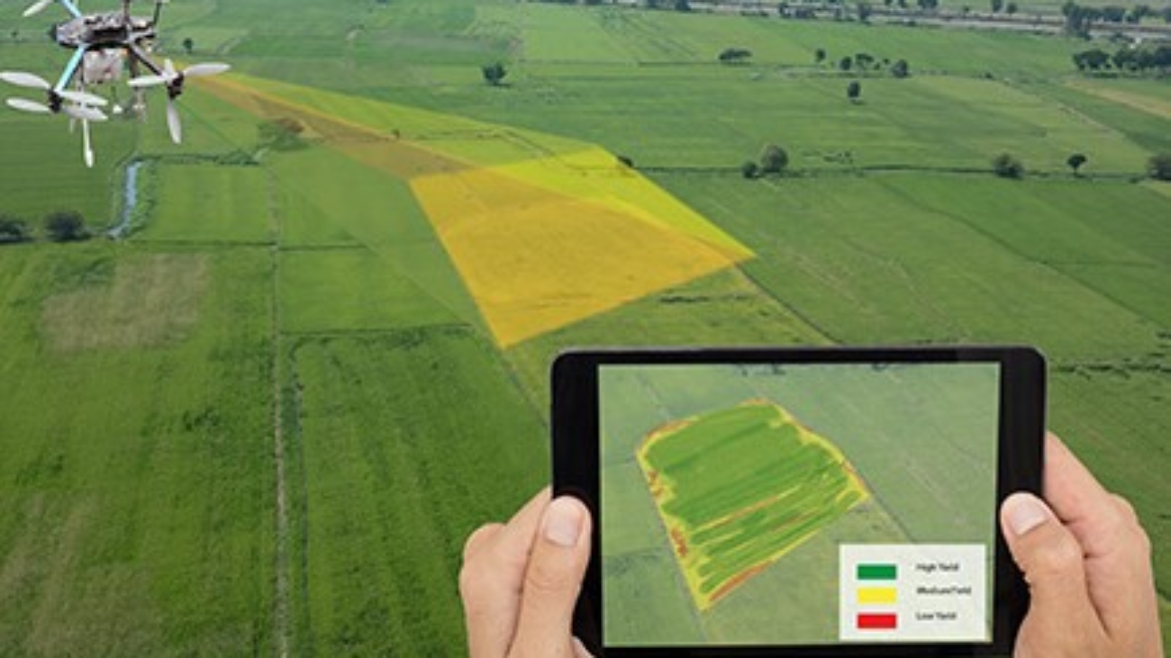
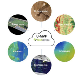
Cohga has teamed up with University of Southern Queensland, Land Solution, and Nursery & Garden Industry Queensland / Queensland Farmers’ Federation, to put on a free half day workshop on key concepts of using drones for smart farming and agriculture purpose.

This workshop will be held on 22 April 2021 in Stanthorpe. You can register and find out more details here.

Hear directly from agricultural, industry professionals and researchers in a series of talks and demonstrations. In this interactive workshop you will learn about cutting edge drone technology and how their products can be used to better manage your farms.

If you would like to know more about how Cohga can assist your agriculture business then please Contact us to start the discussion.

NTG ICT Panel (square)

Cohga Joins Northern Territory Government ICT Panel Contract

Provision of ICT Specialist Services

Cohga is pleased to announce that we have been granted lateral entry to the Northern Territory Government panel contract D19-0147 - Provision of ICT Specialist Services.

Cohga was selected for Stream 1 - ICT Packaged Works under the panel, which will allow us to continue providing our Weave software and services in a more effective and efficient manner.

Cohga Manager Graeme Taylor noted “Cohga has been operating in the Northern Territory since 2013 and entry to this contract confirms our commitment to the local ICT industry.  We are excited by this panel arrangement as it will streamline the procurement process and ensure projects are not delayed.”

Some well-known public Weave systems in the Northern Territory include

NRMAPS – https://nrmaps.nt.gov.au/

STRIKE – http://strike.nt.gov.au/

POINT – https://point.nt.gov.au/

If you would like to know more about how to engage with Cohga under the D19-0147 Panel Contract then please Contact us now to start the discussion.

GDA2020 Logo 2to1

GDA2020 Upgrade Services

GDA2020 Background

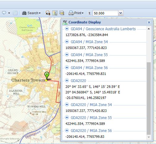
From 1 January 2020 Australia has adopted the GDA2020 datum to represent coordinates on a more accurate and modern global reference frame. As a consequence, spatial information custodians are being encouraged to use GDA2020 as the foundation for their spatial data sets.

For data custodians this will mean converting their spatial data from their current datum (e.g. GDA94) to the new datum, and adopting the associated map projection change.

More information is available from the Intergovernmental Committee on Surveying and Mapping (ICSM) websites on GDA2020 and upgrades to the Australian Geospatial Reference System. Resources include the GDA2020 Technical Manual, FAQs, Fact Sheets and a GDA2020 Forum.

Cohga GDA2020 Services

If you are considering moving to GDA2020 then please contact Cohga to discuss what you will need to do from a Weave perspective. Cohga has a range of upgrade services to suit needs and budget and will work with you to identify what is the best approach for your organisation.

From a project perspective we recommend the following steps:

Plan

It is important to plan this upgrade project well, as the changes being made are significant and need to be carried out in a methodical and structured way. From experience we can advise that the more time spent planning this upgrade the better the outcome, so we encourage you to engage a Project Manager and adopt some Project Planning tools and processes.

Communicate

It is vitally important that your clients – internal and external – are made aware of the changes you are planning as this will assist with the smooth transition to the new system. We encourage a communications strategy that provides clients with timely and informative updates to ensure there are no surprises at any stage of the project.

This communications strategy is also a good opportunity for you to promote yourself and your services by showing your clients that you are working to improve and modernise the system for them.

Test

Your project plan should include conducting a full system upgrade in a test environment before upgrading your production system. This will provide you the opportunity to develop and test all the steps in the process to ensure your system is upgraded correctly and in the most efficient way.

Once you have your plan, scripts and processes defined you will be ready to upgrade your production system.

Execute

If you have planned well and tested your plan then the execution phase should be relatively straight forward and successful. Set aside enough time to roll out the upgraded production system and importantly communicate this change with your clients early.

Take the pain out of the GDA2020 upgrade. Cohga professional services team are ready to work with you and your IT team to deliver a smooth transition. Contact us now to start the discussion.